|
|||||||
| Home | Forum | Online Store | Information | LJ Webcam | Gallery | Register | FAQ | Members List | Social Groups | Calendar | Search | Today's Posts | Mark Forums Read |
 |
|
|
Thread Tools | Display Modes |
 05-14-2017, 07:12 AM
|
#1 |
|
Senior Member
Join Date: May 2007
Location: Palos Verdes
Posts: 1,827
|
Maps of the Redondo area for the Battle of the Bays
The launch will be super easy as it's a dock type launch and the entrance of the harbor is a very safe entry and exit to the outer waters. You should get a map of the area or google some info to find the many artificial reefs and wrecks outside the harbor. The Redondo reef is only about 1 mile outside and the Hermosa Reef is just to the north of the harbor break wall. Notice that big underwater canyon right in front of the harbor....it drops to over 300' deep within 1 mile of the harbor. 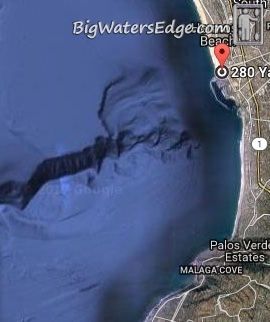 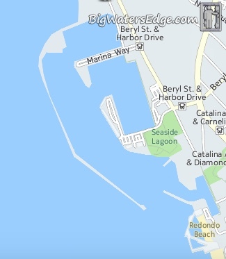 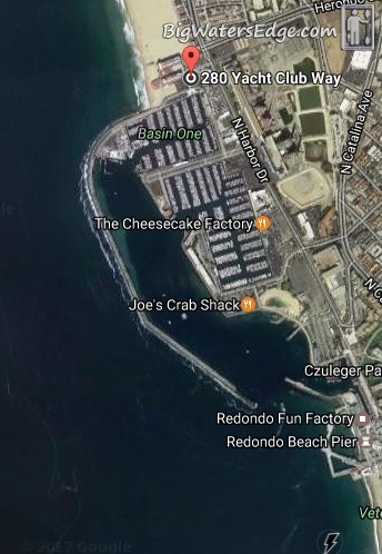 This last map has some shaded areas I've added and this is the only legal areas to fish in the harbor...on the left side of the harbor near the bend in the wall is where the bait barge is located. Those three big dots on the left side are three green bouys that mark the perimeter of the legal areas. 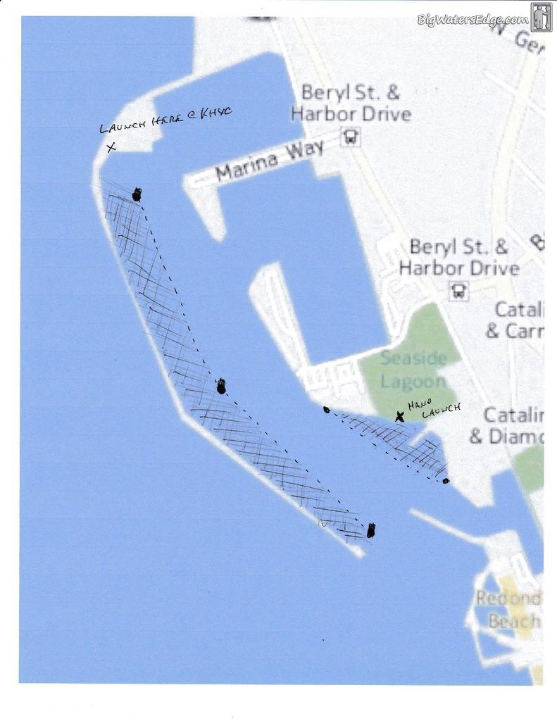
__________________
Jim / Saba Slayer 
|

|

|
|
05-14-2017, 12:37 PM
|
#2 |
|
Junior
Join Date: Mar 2013
Posts: 18
|
What do you use as a source for reef/kelp/wrecks/boey location data? I mean in general for south california, not just redondo
Do you know of a brand of map I can buy, or a place I can download data from, that has high detail bottom composition? I want a map that can tell if I'm over mostly sand or rock, mixed, ect. I only found one in a store and it was zoomed way out to cover almost 20 square miles on a B size paper, that's too low detail to be useful. |
|
|
|
|
05-14-2017, 01:08 PM
|
#3 | |
|
Large Member
Join Date: Jul 2012
Location: La Verne, CA
Posts: 1,001
|
Quote:
|
|
|
|
|
|
| Thread Tools | |
| Display Modes | |
|
|


 Linear Mode

