Kayak Fishing Adventures on Big Water’s Edge  

Go Back   Kayak Fishing Adventures on Big Water’s Edge > Kayak Fishing Forum - Message Board > General Kayak Fishing Discussion
Home Forum Online Store Information LJ Webcam Gallery Register FAQ Community Calendar Today's Posts Search

Reply
 
Thread Tools Display Modes
Old 02-27-2017, 07:52 PM   #1
MITCHELL
Sea Hunter
 
MITCHELL's Avatar
 
Join Date: Nov 2011
Location: Where ever I may roam where I lay my head I call home.
Posts: 2,251
Send a message via AIM to MITCHELL
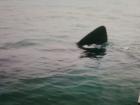
Looks like the MLPA closure on point loma.....

Starts right even with the tip on Zuniga jetty was wondering my last trip out....guess I could have changed screens to check.
Attached Images
File Type: jpg 20170227_204557.jpg (55.1 KB, 167 views)
__________________
Duke Mitchell

Last edited by MITCHELL; 02-28-2017 at 06:51 AM.
MITCHELL is offline   Reply With Quote
Old 02-28-2017, 08:33 AM   #2
kirkdavis
Senior Member
 
kirkdavis's Avatar
 
Join Date: Apr 2015
Location: SD County
Posts: 360
interesting.....

I guess that might make it a little easier to locate without using "fishalerts".
I use fishalerts to keep me out of the MLPAs and also for the bottom contours/rock piles.
kirkdavis is offline   Reply With Quote
Old 02-28-2017, 01:04 PM   #3
MITCHELL
Sea Hunter
 
MITCHELL's Avatar
 
Join Date: Nov 2011
Location: Where ever I may roam where I lay my head I call home.
Posts: 2,251
Send a message via AIM to MITCHELL
How much does that

Quote:
Originally Posted by kirkdavis View Post
I guess that might make it a little easier to locate without using "fishalerts".
I use fishalerts to keep me out of the MLPAs and also for the bottom contours/rock piles.
Cost pre month
__________________
Duke Mitchell
MITCHELL is offline   Reply With Quote
Old 02-28-2017, 02:09 PM   #4
kirkdavis
Senior Member
 
kirkdavis's Avatar
 
Join Date: Apr 2015
Location: SD County
Posts: 360
Free

Quote:
Originally Posted by MITCHELL View Post
Cost pre month
It is free for the basic version. I don't know if they have a premium version because I am a cheapskate, and it has everything I need. It has weather, tides, camera, etc., but the only thing I use is the MPA which tracks your location. Once I get out of the MPA I use it to get over whatever structure I want to fish. I learned to like it when I was rock fishing. The bites would stop, and I would look on Fishalerts and see that I had drifted off of the stucture, then use it and my sonar to get back on. Seem pretty accurate.
kirkdavis is offline   Reply With Quote
Reply


Posting Rules
You may not post new threads
You may not post replies
You may not post attachments
You may not edit your posts

BB code is On
Smilies are On
[IMG] code is On
HTML code is On

Forum Jump


All times are GMT -8. The time now is 07:09 AM.


Powered by vBulletin® Version 3.8.11
Copyright ©2000 - 2024, vBulletin Solutions Inc.
© 2002 Big Water's Edge. All rights reserved.