|
|||||||
| Home | Forum | Online Store | Information | LJ Webcam | Gallery | Register | FAQ | Community | Calendar | Today's Posts | Search |
 |
|
|
Thread Tools | Display Modes |
 10-14-2011, 07:00 PM
|
#1 |
|
Olivenhain Bob

Join Date: May 2008
Location: Olivenhain, CA
Posts: 1,121
|
Another Lesson Learned
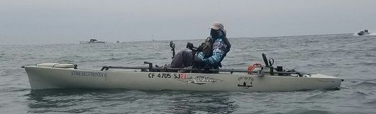
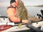
I got to the launch, rigged up and headed out into the tea-colored water. I was all by myself. As I headed out, I ran across another yakfisher coming in, (I will call him Mr. X), who had a nice fish strapped to the back of his kayak. Hopefully Mr. X will tell his story one of these days. About the time I reached the reserve buoys, the marine layer had engulfed me. It was really thick and getting thicker. After about fifteen minutes heading, (hopefully), west, I realized that I had no idea where I was or what direction I was going. The only clue was the occasional bark of a sea lion and the crashing of the waves at some beach, (Boomers?). The marine layer was so thick and dense that I could not even see the sun and use it as a navigational marker. I have been fishing in fog before but never as dense as this. After a while, it became clear to me that if I could not figure out where I was or what direction I was headed, I could be in some serious trouble. The good news is that I have an iPhone that I always carry with me while out fishing. The better news is that this phone has a bunch of tools that helped to save my bacon today. The phone, (along with most smart phones), has a standard compass app. This is great but if you have no idea where you are, just going east to try to get home could have some unforeseen consequences. I could have landed at Boomers and been smacked by a a six foot breaker. I have a couple other apps on my phone which came in very handy today. Most of these apps use GPS coordinates to plot the phone's position at any given time. The savior today was Navionics. This app showed where I was on a nautical map and also showed what direction I was headed. To my great surprise, I found that even though I had been peddling West, (supposedly) for almost an hour against a strong wind, I had not made much progress. I was barely past the reserve buoys and had been heading mostly north. With the help of the iPhone technology, I was able to get myself pointed in the right direction. By noon, the fog had lifted and I was able to get a full day of fishing in. For those who may be interested, there was no catching associated with this day of fishing. The main point of this post is that even for those of us who have spent quite a bit of time on the water, Mom Nature can sometimes dish out some unexpected and dangerous conditions. Smart Phones are great tool that can help yakfishers cope with with problems on the water. My recommendation is that you have a smart phone, load it up with the appropriate safety and navigation apps and bring it with you. If you do not have a smart phone, you should seriously consider getting one. Bob |

|

|
|
10-14-2011, 07:05 PM
|
#2 |
|
Currently @ MLO Territory

Join Date: Dec 2010
Location: Under the Shadow
Posts: 2,290
|
D-safety, Are you actually admitting on this post??? That you do not have an actual compass on your kayak???
 Must of been a nightmare not know which direction was which, thanks for the report this is one reason i carry my iphone with me too.
__________________
 Team: Disbanded You only have one chance in this life...make the right decision(s)...so you don't regret it
|
|
|
|
|
10-14-2011, 07:10 PM
|
#3 |
|
CEO of Team Roby
Join Date: Sep 2010
Posts: 905
|
I'm glad you made it back safely Bob. Thanks for the report and advice
|
|
|
|
|
10-14-2011, 07:18 PM
|
#4 |
|
Member
Join Date: Sep 2011
Posts: 36
|
Dsafety, are you familiar with the Navionics App for iphone?
|
|
|
|
|
10-14-2011, 07:22 PM
|
#5 | |
|
Senior Member

Join Date: Apr 2010
Posts: 6,855
|
Quote:
Ditto! I've been in that situation before, I was in some night time fog that was so thick my GPS antenna was actually loosing its signal. I recall getting to the point when I was ready to call the USCG and ask for assistance getting in. The worst part of this was that I was with my son and we were inside the breakwall in Long Beach right outside of Los Alamitos bay.....so close yet so far. Glad you made it home safely.
__________________
 www.facebook.com/Teamsewer |
|
|
|
|
|
10-14-2011, 07:41 PM
|
#6 |
|
Greg
Join Date: May 2010
Location: Chula Vista, ca
Posts: 509
|
I too went fishing today, but went to the Bay. The Bay is busy enough on a clear day, but with visibility of less than 100 feet, just plain crazy out there.
Some PB'ers were carefull, lots of horn blowing. Then some were cruising as if they could see for miles. I was already a few hours into my day of fishing, and an hour peddle out to the mouth of the Jetty when the marine layer rolled in.. There was no turning around. All I could do was fish around the buoy, figuring that was my safest bet. As you'll see from the pics, even the Navy and tugboats were hugging the buoys. Just what is it?  . . . . . . . . . . . . . . . .. . . . . . . .. . . . . . . .  Yep, there were ships and subs of every variety coming in and out of the bay today! 
Last edited by Regor; 10-15-2011 at 09:24 AM. |
|
|
|
|
10-14-2011, 07:45 PM
|
#7 |
|
Currently @ MLO Territory
Join Date: Dec 2010
Location: Under the Shadow
Posts: 2,290
|
Cool BEANs!!!
You should of asked for a tour of the sub 
__________________
Team: Disbanded You only have one chance in this life...make the right decision(s)...so you don't regret it
|
|
|
|
|
10-14-2011, 08:00 PM
|
#8 | |
|
Senior Member
Join Date: Sep 2009
Location: newbury park ca
Posts: 2,323
|
Quote:

|
|
|
|
|
|
10-14-2011, 08:05 PM
|
#9 |
|
Senior Member
Join Date: Sep 2010
Posts: 736
|
Bob-
Good seeing you today... I don't want you to take this as a dig because I think your a really nice dude but; Go buy the forty dollar ritchie compass, electronics fail and direction and bearing are important for your safety.... You can somewhat easily navigate the whiteout if needed by following the lobby buoys back along the point and into the reserve.... You or anyone might be comfortable in that setting but what about the other guy flying around in the cabin cruiser like today .. That could turn bad quick...BUY A REAL COMPASS...... I hope you enjoyed the fishing time though, that terrible red tide kept things peaceful. Hopefully your drive got fixed too buddy I dont care what anyone says I love the lobster buoys makes fishing more fun and safe 
|
|
|
|
|
10-14-2011, 08:11 PM
|
#10 | |
|
Senior Member
Join Date: Sep 2009
Location: newbury park ca
Posts: 2,323
|
Quote:
|
|
|
|
|
|
10-14-2011, 09:17 PM
|
#11 | |
|
Olivenhain Bob
Join Date: May 2008
Location: Olivenhain, CA
Posts: 1,121
|
Quote:
For all of those ragging about not having a compass on the boat, the one on my phone works just fine. Unless the phone battery fails, it is just as good as any that I might mount on the boat. The problem today was one that a compass could not solve. I could figure out what direction I was going but not where I was. To be truthful, I was probably never in very much danger. I could always find land by just heading east or heading toward the barking sea lions or the sound of the surf. The point that I am trying to make in this post is that if you have a smart phone, (these days you can buy one for less than $50), you can load apps that can come in very handy when stuff like this comes up. Bob |
|
|
|
|
|
10-14-2011, 09:20 PM
|
#12 |
|
Senior Member
Join Date: Mar 2009
Posts: 2,384
|
Unless you are charting your course, a compass is not going to be of much help in those conditions. I will grant that it could point you towards land (East), but it is not going to show you the way home or a safe landing for that matter.
|
|
|
|
|
10-15-2011, 06:32 AM
|
#13 |
|
Senior Member
Join Date: Jan 2008
Location: Costa Mesa
Posts: 278
|
I fished at Dana Point yesterday and about 1:00 the fog came in very heavy. I was out at the kelp in front of Salt Creek. I always carry a small handheld GPS and just followed my track line back to the harbor.
|
|
|
|
|
10-15-2011, 06:52 AM
|
#14 |
|
Senior Member
Join Date: Dec 2008
Location: Redlands CA
Posts: 871
|
And if you are going to get a smart phone,consider the G'zone Commando WATERPROOF ANDROID !!!
Glad you are OK.Fog can be freaky.I love when it lifts to reveal a sunny day! Eventually someone will put a radar on their kayak.I would have bet Doug(DGAX) would have been the first,but I think he moved out of state...
__________________
Barachit Baralah,Elohim-In the beginning,God-Genesis 1:1  "Who among you,if your son asked for a fish would give them a serpent " Jesus Matt. 7:10 |
|
|
|
|
10-15-2011, 07:36 AM
|
#15 | |
|
Senior Member
Join Date: Jul 2006
Posts: 218
|
Quote:
I carried a compass for years, never used it. When fog is pea soup thick, you can use the swell direction to get your bearing. At La Jolla, I launched in pea soup many time before and used the just the swell to guide myself to the pier for bait (compass stayed inside the dry box all the time), then hop from reserve bouy to reserve bouy to the corner of the reserve, then went towards the point using just the swell as guide, then along the kelp edge to the outside. Never using the compass I was carrying. A GPS is much more useful, you can still fish your designated spots and not just directionally navigate. A handheld GPS is cheap and useful on every outing. (Walmart is having a clearance, they are discontinuing their handheld GPS... If they have any left over that is. A Garmin Venture HC is only $20 (normally around $100), A magellan Triton 500 for $80 (Normally $250)). |
|
|
|
|
|
10-15-2011, 08:55 AM
|
#16 |
|
The carpetbagger
Join Date: Sep 2011
Location: tha newps
Posts: 1,474
|
Got store cred at walmart! Whoop whoop!!! On my way!

|
|
|
|
|
10-15-2011, 09:04 AM
|
#17 |
|
The carpetbagger
Join Date: Sep 2011
Location: tha newps
Posts: 1,474
|
I think the point dsafety was making is that we have an extra availible resourse at our desposal that often goes unnoticed. My friend hooked into a mama thresher on wed. that took him on a 3 hour sled ride almost 10 miles towards catalina. Wasn't until the battle was over that he realized the battery on his finder/gps had died. Lucky for him it was a clear day and no fog bank rolled in but the next day he said that's all he could think about the whole time. I asked him if he had a smart phone and if he could just use the gps on that. He never even thought to use it. Its a powerful tool that often gets overlooked. But I also agree that it should be a backup and not a primary saftey tool. Phones are not as reliable as electronics made to perform in the conditions we are using them in.
|
|
|
|
|
10-15-2011, 02:56 PM
|
#18 |
|
Senior Member

Join Date: Jun 2011
Posts: 364
|
Thanx for sharing this. I'm new to kayak fishing. Getting lost in the fog is something I never payed a thought to. This story is an eye opener.
|
|
|
|
|
10-15-2011, 04:19 PM
|
#19 | |
|
Senior Member

Join Date: Aug 2009
Location: Carlsbad
Posts: 591
|
Quote:
|
|
|
|
|
|
10-15-2011, 04:37 PM
|
#20 | |
|
The carpetbagger
Join Date: Sep 2011
Location: tha newps
Posts: 1,474
|
Quote:
 to whatever was on the other end to whatever was on the other end
|
|
|
|
|
|
|
|


 Linear Mode

