 02-14-2011, 11:11 AM
|
#1 |
|
Senior Member

Join Date: Apr 2010
Posts: 6,856
|
Portable GPS
What do you like/dislike about it? |

|

|
|
02-14-2011, 12:48 PM
|
#2 |
|
Senior Member

Join Date: Mar 2010
Location: San Diego
Posts: 2,385
|
http://catalog.ebay.com/Garmin-GPS-12-GPS-Receiver-/48465169?_pcatid=43&_refkw=Garmin+Handheld+GPS&_trkparms=65%253A12%257C66%253A2%257C39%253A1%257C 72%253A4730&_trksid=p3286.c0.m14
The Garmin GPS 12 Handheld is what I have. I've had it for 3 years now and it is everything I need, it is easy to use and it shows you the way to your marks. It is a workhorse. The newer versions of this are nice but they seem to have a lot of issues with the screens. |
|
|
|
|
02-14-2011, 12:54 PM
|
#3 |
|
Senior Member

Join Date: Mar 2005
Location: Leucadia, CA
Posts: 261
|
Waterproof & floats. I have it loaded with road, topo and on the water charts. $220 from the GPSstore.
|
|
|
|
|
02-14-2011, 01:54 PM
|
#4 |
|
Senior Member

Join Date: Mar 2010
Location: Santee
Posts: 904
|
this:
 running this: http://gps.motionx.com/iphone/overview/ inside this:  I also run this for depth info:  from: http://www.flytomap.com/ftm/mapcatg.aspx The two GPS/Nav apps were $5 total. The phone was a little more. The bag was about $30 - not good for taking pics. As for the GPS app, easy to use. Waypoints easy to enter, and easy to set for navigating. Easy to set up to create tracks and can e-mail to home PC. Can also set up the GPS to send out positional info via e-mail every 15 minutes so wifey can see if I go way off course in the event something goes wrong. The FlyToMap app is very basic and provides little use other than indicating on a chart the depth and location. Without a FF, it is good for depth info. |
|
|
|
|
02-18-2011, 01:15 PM
|
#5 |
|
Senior Member

Join Date: Feb 2011
Location: Carlsbad
Posts: 143
|
Old Rookie - That is really cool that you can use your iPhone as a GPS. This is super tempting to me because I am a sucker for simplicity.
How certain are you of the accuracy on the iPhone. I've got the 4G and whenever I've used it for GPS location on Google or another application like say, a jogging app, the phone can't really do better than 20-40ft of my position. This is enough accuracy for me to justify not buying a handheld, but I'm curious how well it has done for you? Any examples or stories would be great. |
|
|
|
|
02-18-2011, 01:20 PM
|
#6 |
|
Senior Member
Join Date: Mar 2010
Location: San Diego
Posts: 2,385
|
I have a blackberry so I can use that Ap. I still like my Garmin though.
|
|
|
|
|
02-23-2011, 08:46 PM
|
#7 | |
|
Senior Member
Join Date: Mar 2010
Location: Santee
Posts: 904
|
Quote:
|
|
|
|
|
|
02-24-2011, 05:44 PM
|
#8 |
|
Leo

Join Date: Feb 2010
Location: La Jolla, CA
Posts: 482
|
I got a Lowrance Finder H2Oc with Nautic Path chip & tell you the truth, I'm real happy with it; for so many years I depend more on it than my FF X67c
|
|
|
|
|
03-24-2011, 10:22 AM
|
#9 | |
|
Senior Member
Join Date: Feb 2011
Location: Carlsbad
Posts: 143
|
Quote:
Thanks so much man, I bought this case for my phone and the iphone app too. Haven't taken it on the water yet but so far I am really excited by what I see. |
|
|
|
|
|
03-24-2011, 06:22 PM
|
#10 |
|
.

Join Date: May 2010
Posts: 1,155
|
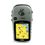
i have a garmin etrex vista C with blue charts and it's compact and works well. you should be able to pick up a used one cheap!
__________________

|
|
|
|
|
03-24-2011, 08:32 PM
|
#11 |
|
Senior Member

Join Date: Feb 2011
Location: Wrightwood
Posts: 623
|
+1 for the Etrex Vista, I didn't even know about the bluechart program for it, I use mine primarily for hunting but I mark waypoints for good fish bites. I think I need to buy bluechart for mine
|
|
|
|
 |
| Thread Tools | |
| Display Modes | |
|
|


 Linear Mode

